SKU
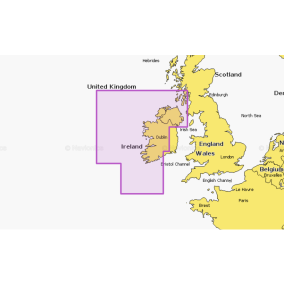
Ireland West Coast
Coastal coverage of the north and western coasts of Ireland from Cork to Belfast including the entire Shannon Inland and Shannon-Erne Waterways, Galway Bay, and Lough Neagh. Also included is the southwestern Scottish coast from Colonsay to Campbelltown.
Card type: SD/MSD
As low as
£124.99
| Navionics+ | Platinum+ | |
|---|---|---|
| Coastal Content | • | • |
| Inland Content | 42,000+ lakes |
42,000+ lakes |
| Detailed Nautical Charts | • | • |
| Daily Updates1 | • | • |
| Dock-to-dock Route Guidance 1,2 | • | • |
| Plotter Sync1 | • | • |
| Community Edits | • | • |
| Advanced Map Options1 | • | • |
| SonarChartTM Live Mapping3 | • | • |
| Relief Shading1 | Via Chart Installer | |
| Satellite Imagery with SonarChartTM Shading Overlay1 | Via Chart Installer | |
| Aerial Photography | • | |
| 3D View | • |


